By Phil Laino
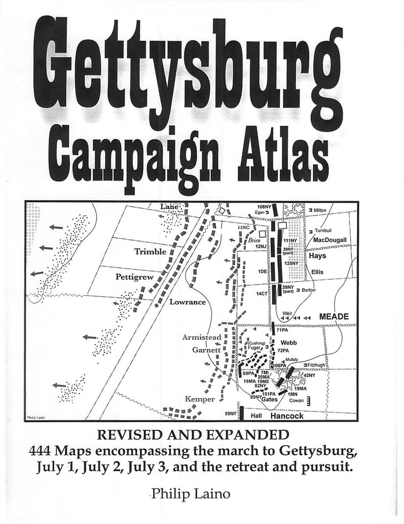
From June 3, 1863, when Robert E. Lee began his campaign to invade the North until July 14 when his army made their way across the Potomac River back to Virginia, the Gettysburg Campaign covered a lot of territory. Here in one volume is the entire campaign, covered in 421 maps.
Created by Philip Laino, cartographer for The Gettysburg Magazine, the Gettysburg Campaign Atlas covers the campaign and battle in great detail. Day Two alone is detailed in 166 separate maps. In addition to the maps, the Atlas contains additional information, including:
- charts listing the regiments from each state, including the regimental and brigade commanders, regimental strength, and percentage of casualties
- a detailed Order of Battle including commanders, estimated strength, casualties (broken down into killed, wounded, and missing), and casualty percentage rates
- bibliography
- index
The Atlas is a spiral bound book. This allows it to lay flat and makes it easy and convenient to use. It also allows for easier use on the battlefield. At 481 pages, this book makes a great addition to any Civil War enthusiast's library.
- Spiral bound
- 510 pages
- S/L #1010